.jpg)
Persian Gulf Historical Map's
PERSIAN GULF in the map of Iran ,French text, from “Vivien de Saint-Martin & Schrader’s Atlas Universal de Geographie” , published by Hachette , Paris , 1919-22
SINUS PERSICUS in the Ptolemy’s map of Arabia Felix , from “History of Arabs” by Philip K.Hitti , English text , 9 th ed .Published by MacMillan Book Co.New York ,1967.
“BAHR-E-FARS” (Persian Sea) in an Arabic map of Babel , Iraq , Khuzestan , made in 9 th Century , from “The History of Humanity” , Russian text, Printed in St.Petersburg , 1898
PERSIAN SEA in the map of Iraq and Khuzestan , from “Al Masalek , val Mamalek” , by “Abolhasan Ebrahim-e-Estakhri” , 950 A.D. , translated into Farsi , edited by Iraj Afshar , published by B.T.N.K. , Tehran , 1961
“BAHR-E-FARS” (Persian Sea) , in the map of Send & Mokran Provinces , Arabic text, 9 th Century ,from “National Geographic Magazine” , No . 1 , Vol .129 , January , 1966.
Original in the “Sheikh Haqmud” Library, Mecca.
PERSIAN SEA in the map of Pars Province , Persian text, from Farsi translation of “Al Masalek val Mamalek” , by Estakhri , edited by Iraj Afshar , published by B.T.N.K.Tehran ,1961
PERSIAN SEA in the map of Iraq & Khuzestan , Arabic text, from “Classical Islam , a History 600-1258” ,translated by Katherine Watson , published by George Allen 7 Unwin Ltd .London ,1958.
Map of Persian Sea “Bahr-e-Fars” , in “Sourat-ol-Arz” , by “Ebne Howqal” , in Arabic text, translated into Farsi by Ja’afer Shoar ,published by , Iran Cultural Fondation , Tehran .
Map of Persian Sea , Arabic text, from “Configuration de laTerre “ (Sourat-ol-Arz) translated into French by J.H.Kramers and G.Weit,published by Editions G.P.Maisonneuve & Larose , Paris , 1964
Outline map of Persian Sea ,from “Configuration de la Terre” , Translated into French by J.H. Kramers , and G.Weit published by Edition G.P. Maisonneuve and Larose , Paris , 1964.
Map of “Bahr-e-Fars” (Persian Sea) in Farsi Translation of “Al Masalek val Mamalek” , Estakhri , edited by Iraj Afshar , published by B.T.N.K. , Tehran , 1961.
Map of “Gomron” and Hormoz Strait , & “Golphe Persique” , from “Voyage en Perse” , by J.B.Tavernier , 1668 , Persian translation bu”Abu-Torab-e-Nuri” (Nazm-od-Dowle) , published by “Ta ‘ aeed Bookshop” , Isfahan , 1958
SINUS PERSICUS in the Tabula VI of Sebastian Munster,s Arabia Felix From “ A history of cartography “ by R.V. Tooley Published by Thames & Hudson London - 1969
Pictorial map of Gombroon , Persian Gulf , and Hormoz Strait , in Tavernier’s “Persian Travels” ,1680 A.D. , from “The Famous Cities of Iran” by Laurence Lockhart , published by Walter Pearce and Co . Brentford , Middlesex , 1939
SINUS PERSICUS in the map of “Kanaan , the Earth’s Paradise” and Arabian Felix , Hebrew and Latin text, drawn in 1678 , from “the History of Humanity” , Russian text , St.petersburg , 1896
a . Map of Sinus Persicus , by Claudius Ptolemy , reproduced in 1482 A.D.
b . Map of Sinus Persicus , by C.Niebuhr, 1792 A.D. From “The Kuwait Urbanization” , by Eng . Dr. Saba George Shibes , published by Kuwait Government Printing Press.
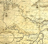
Map of “Perzische Golf” in 17 th Century A.D. , from “Spiegel Histoiael Maandblad” , Dutch text ,printed in Amsterdam , September 1967
A picture of Hormoz Island ( in Persian Gulf) ,from “Children and Youth ‘ s Encyclopedia” , Russian text ,printed in Moscow , 1968.
A picture of Hormoz City , from “Persian Gulf” , by Lt. Sir Arnold T. Wilson , translated into Persian by M. Saidi , first
An old map of Kharg Island in Persian Gulf from “Spiegel Hostoriael Maandblad ,published by Woorgeschiedenise en Archeologie , Amsterdam , September 1967
A picture of Hormoz Island in Persian Gulf , from “Histoir Mondial des Explorations , L’Homme et La Decouverte de la Terre” , by Frank Debenham , published by Librairie Hachette , Paris , printed in Holland , 1964
An old picture of Hormoz Island in Persian Gulf ,from “General History of The World” , published by The Academy of Sciences of The U.S.S.R. , Moscow , 1965
North Bahrain in 1635 , a Portuguese book on India , (Photo : Courtesy of Royal Egyptian Geographical Society) , from “Welcome to Bahrain” , by James H.D. Belgrave , Third edition ,printed in London 1957
Map of Persian Gulf (Golfe Persique) , French text, in J.B.d ‘ Anville’s Atlas , Paris 1790 , from “Die Erforschung Persiens” , by Alfons Gabriel , published by Verlag Adolf Holzhausens N.F.G. , Wien , 1952.
Bandar-Abbas , a view of “Gammeron or the Citie Bandar Abbassie” , reproduced from “The Voyages and Travels of John Struys” , 1684
PERSIAN GULF in the “map of Ancient Sites of Iraq” and “Map Showing Suggeted Course of Two Rivers in Early Times” (Persian Gulf in 3100 B.C. ) from “Map of Iraq” , Published by Government of Iraq , Baghdad , 1929
PERSIAN GULF and Arabian Gulf (Red Sea) in the map of Arab Countries , from “History of Islamic Civilization” , by Georgi Zaidan , Turkish translation by Ahmad Jovdat and Zaki Moghamer , published by Saadat Printing House , Istanbul , 1328 Hijri .
“AL-KHALIJ-AL-FARSI” (Persian Gulf) in the map of Islamic Boundaries in the Time of Second Caliphate “Omar –ebne- Khattab” , from “the Life of Farouq-e-A’azam” ,by Hosein Haikal , Persian translation by “Fazle-men-Allah Fazli” ,published by Book Printing Kabul , 1968
“AL-KHALIJ-AL-FARSI” (Persian Gulf) in the map of Iran & Arabian Felix , Arabic text from “A Guide to History & Geography of Elementary Schools” , Published by “Maktab-ol-Asria , At-Tabaa’-val –Nashr” , Saida , Beiruth ,1960
“BAHR-E-FARS” (Persian Sea) and “Khalij-al-Arab” , (Red Sea) in the map of Lands of Arabs ,from “Historical Maps” , by Ahmad Saleh , Teacher of “Naseriyeh”Teachers ‘ School ,Published by “Ma ‘ aref” Printing House , Cairo ,1914
“AL-KHALIJ-AL-FARSI” (Persian Gulf) in the map of Iraq , Arabic text , from “Third Week of Rehabilitation” , published by Ministry of Rehabilitation , Government of Iraq ,Baghdad ,1958
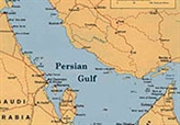
PERSIAN GULF in the map of Saudi Arabia , English text, from “Report of Operation to the Saudi Arabian Government” annual published by Arabian –American Oil Company ,1956
“AL-KHALIJ-AL-FARSI” (Persian Gulf) in the political map of Iraq ,from “Al-Monjed” , (A Dictionary of Arab Words ) ,15 th edition , Catholic Printing House , Beirouth ,1965
Guide map of Bahrain Island in Persian Gulf , English text, from “Wel come to Bahrain “ by James H.D.Belgrave , Second edition , printed in London , 1955
The following maps were obtained after the main volume was already printed . In view of the importance of the maps they are being appended here under
“SINUS PERSICUS” in the World map of Posidonius , 130-50 B.C. , Latin text , from “History of Cartography”,by R.V.Tooley , published by Thames & Hudson , London , 1969
“BAHR-E-FARS” (Persian Sea) , in the map of Iraq , Arabic text, from “Sovarel-Aqalim-as-Sabaa” , by “Abi-Zaid-Balkhi” , in 10 th Century ,from “Alvai” a magazine ,printed in Cairo .
“DARYAYE-FARS” (Persian Sea) in the map of Moselem ‘ s Lands ,from “Islam and her Civilization” , by Andre Miquel ,published by Armand Colin . This map is copied from the World map of “Shamsed-Din Abu-Abdollah-e-Moqaddassi” by Serge Bonin (French Cartographer) .Paris ,1968
“BAHR-E-FARS” (Persian Sea) , in three maps of the World , by : “Abu-Abdollah-Zakariya-Mohammad –ebne-Mahmood-e-Qazvini” “Abol-Hassan-e-Ebrahim-e-Estakhri’ ,and “Abol-Qassem-ebne-Ahmad-e-Jeyhani” .From “The Philosophy of Geography” ,Farsi text , by Hassan Shokuee Published by Tabriz University , 1970
